
EDITORIAL
Last month, I attended the 20th anniversary of the Baveno meeting which established the GMES programme which has now become Copernicus. The Baveno Manifesto was a landmark document put together by representatives of Europe’s space agencies under the guidance of the European Commission.
INTERVIEW
Interview with Vicente Caruz - President of Eurochile Foundation.
The Eurochile Business Foundation was jointly established by the Chilean state and the European Union in 1993. It was created by Chilean law which, apart from defining its fields of action, gave it certain permanent benefits.
Its objective is to promote and strengthen economic and industrial cooperation and technology transfer between the European Union and Chile. Its main method of work is through lines and projects to increase the capacity of management, innovation, staff training, production and marketing of national companies. All of this has a primary focus on promoting SMEs on order to enhance its competitiveness, productivity, and internationalization.
INDUSTRY PROFILE

DRAXIS was founded in 2000 in Thessaloniki – Greece. During the early years, DRAXIS’s field of interest was the implementation of environmental studies and the provision of consulting services. Later on, and with a small dedicated group of experts, DRAXISexpanded into the environmental ICT sector; it was one of the first and few companies in Greece active in this domain.
EARSC ACTIVITIES
Case Study: Peatland Management in the UK
Copernicus Sentinel data is
being used by water utilities in the UK to improve the management of peatlands,
leading to better water quality for local citizens, reduced costs of
purification for the water
companies and strong environmental benefits.
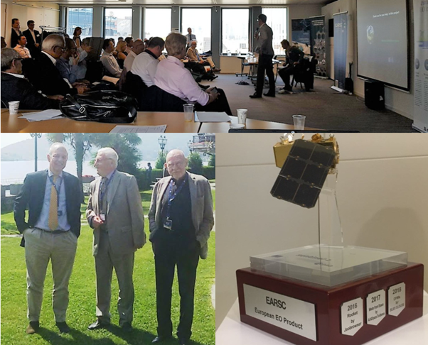
Dust Frequency Maps is the European EO Product Award 2018
The EARSC competition “European EO product of the year” rewarded a company which has developed a product which will support the implementation of the Sustainable Development Goals (SDGs) at national, regional and/or local levels, and the monitoring and reporting against the global indicator framework.
The European Association of Remote Sensing Companies (EARSC) and the Eurochile Business Foundation, signed a Memorandum of Understanding (MoU), establishing a formal cooperation initiative between EARSC, responsible for promoting the use of Earth Observation (EO) technology and supporting companies in Europe which offer EO-related products and services, and Eurochile, responsible for promoting economic, trade, and technological cooperation between the private sector and institutions in Chile and the European Union, through business promotion, and the transfer of technology and know-how.
Geospatial World Forum will be organized in Amsterdam on 2-4 April 2019
EARSC has confirmed as Supporting Partner of Geospatial World Forum 2019. The Forum is a collaborative and interactive platform, which demonstrates collective and shared vision of the global geospatial community. It is an annual gathering of 1500+ geospatial professionals and leaders representing the entire geospatial ecosystem. Coming to its 11th edition, Geospatial World Forum has become the most talked about geospatial event, best-known for its futuristic themes, engaging content, and top-level attendees.
Sinergise is the winner of the EARSC Company Achievement Award 2018
On the 26th June 2018, Sinergise was presented with the EARSC Company Achievement Award during the Association’s Annual cocktail, held in Brussels.
You can now follow IDEEO on different platforms!
The overarching objective
of the IDEEO project is the creation of a new European partnership
which will promote internationally the use of European Earth Observation
capability in different sectors such as marine, agriculture, energy etc. In
order to meet the expected impacts specified by the Call.
Now you can follow the project on different platforms!
MEMBER NEWS
Airborne Technologies breaks the ice
Airborne Technologies is proud to have obtained FIKI certification from EASA for the Vulcanair P68R.The aircraft type is thus approved for “Flights Into Known Icing” conditions.
Airbus launches OnePlan for TerraSAR-X – enabling online tasking for radar satellites
AIRBUS excited to announce that the One Tasking service has now been extended to our Synthetic Aperture Radar (SAR) satellites. With the launch of OnePlan for TerraSAR-X, AIRBUS is strengthening their multi-sensor offer, giving us the opportunity to simply select the best sensor for our projects and to obtain the imagery you requested exactly when you need it!
CGG's Helitem shatters AEM Low-frequency barrier to target deeper resouces
CGG Multi-Physics is pleased to announce that its Helitem helicopter time-domain electromagnetic system has successfully acquired high-quality, broad-spectrum Airborne Electromagnetic (AEM) data at a base frequency of 7.5 Hz. This is a significant breakthrough for resource exploration worldwide, and an industry first.
VisioTerra has developed a fully automated change detection service enabling users to see the history of changes detected in specified monitored areas.
Earth-i flies the flag for the growing UK space sector
Earth-i was recently named the number one “new space” company in Europe; quite an achievement for a company only 3 years old.
European Land Monitoring at its crossroads – opportunities and challenges
We would like to invite you to “European Land Monitoring at its crossroads – opportunities and challenges”, a conference to be held in Innsbruck, Austria. This conference will be organised under the auspices of the Austrian Presidency of the Council of the European Union.
JupyTEP IDE available for test usage
Under ESA contract our team has developed a cloud-based IDE (Integrated Development Environment) for building scripts, algorithms and also complete EO data processing chains. JupyTEP IDE is a software with preconfigured EO toolboxes (e.g. SNAP/Snappy and Orfeo ToolBox) and libraries for GIS processing (e.g. GDAL, Grass GIS, PostGIS).
Multi-Mission SAR at Oil-on-Water 2018
The Norwegian Oil-on-Water (OPV) exercise is unique. Norway being one of the very few countries that allow the release of actual oil on water, it attracts international participation and attention. KSAT, an important contributor since many years, ensures satellite acquisitions from a broad variety of satellites throughout the entire drill.
National Agenda Photonics new impulse for dutch industry
The Netherlands has a strong international position in the application of photonics. This innovative lighting technology contributes to the solutions for societal challenges in the ICT, manufacturing, semicon, health, agri-food, environment & energy sectors. To accelerate the opportunities of photonics technologies, the National Photonics Agenda is published today. The agenda describes how the Netherlands can further strengthen its leading global position in the coming years, an ambition that is seamlessly aligned with the innovation and top sector policy.
New CEO at GAF AG: Dr. Sebastian Carl takes over from Dr. Peter Volk on 1 July 2018
After 32 years of working for GAF and more than 11 years in the position of CEO, Peter Volk stepped down from the latter position as planned on 30 June 2018. On 1 July, Sebastian Carl took over as CEO of GAF.
New generation of GNSS user terminals implementing the Galileo authentication capability
FDC recently started the PATROL project that aims to develop, supply and test Galileo’s Open Service Navigation Message Authentication (OS NMA).
The National Geospatial-Intelligence Agency (NGA) has selected Hexagon US Federal as a prime contractor on two multiple awards, indefinite delivery/indefinite quantity contracts for amounts totaling $1.17 billion. Hexagon was selected as one of multiple vendors for the JANUS Geography and JANUS Elevation contracts.
Our newest innovation: chatbots and satellite imaging
Geocento has recently commenced an InnovateUK project which will apply Chatbot natural language processing to the satellite imaging business with the aim of making the process of discovering and ordering imagery much easier. We are currently in the process of designing the intents associated with user interactions, the workflows and entities (key parameters) associated with these interactions and the information needed to fulfil an enquiry.
Planet And Airbus Partner To Deliver New Geospatial Solutions
Planet is expanding its engagement in Europe in a big way. Today, we’re excited to announce a partnership with Airbus, a leader in remote sensing, to enable access to each other’s data and joint cooperation on the development of new geospatial solutions.
Satellite Derived Bathymetry in Arctic waters – successfully validated and ready to be used!
The Arctic is a huge and remote place where physical conditions are extremely challenging. This has always affected field campaigns in terms of health and safety issues and with huge associated costs. Consequently, there is still a big lack of detailed up-to-date maps of the arctic coastal zone which significantly affects the navigational safety in the area. With the increased activity level in the region due to opening of the ice waters, increased tourism, exploration for natural resources etc., this is a big cause for concern for both human lives and potential environmental disasters from groundings. At DHI GRAS, we are working on minimising these risks. With modern satellites and advanced physical modeling of the water column, it is possible to derive reliable water depths in shallow waters at low costs with no risks associated.
SAVE THE DATE: GIS in the European Union - 7–8 November 2018
The European Union (EU) faces many challenges economically, socially, and environmentally. Location intelligence is a key element when it comes to making better decisions and formulating policy to create a stronger, more united, and connected digital Europe.
Simularity and Geospatial Enabling Technologies (GET) Sign Partnership MOU
Exploiting a huge volume of free available Copernicus System Sentinel-2 satellite data, being collected daily, can be easily and effectively only with the use of artificial intelligence. This is what our partnership with Simulirity provides to us, through Simularity’s artificial intelligence solution for satellite data, Automated Image Anomaly Detection System (AIADS). This solution massively provides the capacity to detect land use changes in time series of big volume satellite imagery (e.g. Sentinel-2), in a very simple, effective and successful way (http://simularity.com/solutions/satellite-anomaly-detection/).
UrtheDaily™ is go, the future of transformational insights is now
Deimos Imaging’s parent company, UrtheCast, announced on May 19th the signature of a credit agreement for US$142 Million to finance the construction, launch and deployment of the UrtheDaily™ Constellation. This important milestone brings the implementation of UrtheDaily™ one step closer.
When Mapping Saves Lives: Supporting the Ebola Response in DRC
While the world watched their soccer team compete in the World Cup qualifiers, the people in the Democratic Republic of Congo were fighting to contain an Ebola outbreak—for the fourth time since 2012. On May 8, the government of DRC declared the latest outbreak in Equateur Province. When it jumped a few days later to Mbandaka, a major transport hub along the Congo River that’s 150 km from the original case, the risk of Ebola spreading internationally became a reality.
EARTH OBSERVATION NEWS
Atos announces satellite data platform Mundi is now live
Paris, 21 June 2018 – Atos, a global leader in digital transformation, today announces that its new Earth Observation (EO) Platform, officially named Mundi Web Services, is now live and being used by several clients. This platform is supported by a newly-created consortium, composed of DLR, e-Geos, EOX, GAF, Sinergise, Spacemetric, Thales Alenia Space and T-Systems, which is led by Atos, on behalf of the European Commission andESA (European Space Agency).
Creating Mobile Apps with Big Data from Space at the Free Space App Camp 2018
The European Space Agency
(ESA) invites 20 committed developers to its Space App Camp,
a free event scheduled for 17-24 September 2018 at ESRIN, ESA’s Centre for
Earth
observation (EO), in Frascati, Italy.
CREODIAS SUCCESSFULLY LAUNCHED at BAVENO+20
On 20-21 June, CREODIAS was presented to the honorary members of Copernicus, European Union, the EO industry as well as to the open public. Our participation involved presenting CREODIAS by means of an unique video, which provided information concering the platform, as well as provided guidelines for potential business to come.
EO4GEO – facilitating capacity building in space geoinformation sector
In a recent press release of June 18, 2018, the EC has proposed to devote €16 billion to help maintain and further enhance the EU’s leadership in space between 2021-2027. Copernicus, the EU’s Earth Observation programme, will receive €5.8 billion. Space technology, data, and services have become indispensable in the daily lives of Europeans and play an essential role in preserving many strategic interests. The budget proposal builds on the Space Strategy for Europe of October 2016 and on the Industrial Policy Strategy presented by President Juncker in his 2017 State of the Union address. They are both a strategic vision for a smart, innovative and sustainable industry in response to growing global competition and major technological shifts.
GEO-CRADLE organised the 3rd South-Eastern Europe GEO Workshop
GEO-CRADLE organised the 3rd South-Eastern Europe GEO Workshop on the uptake of GEO and Copernicus, with emphasis on Climate Change, Food Security and Water Extremes, Raw Materials and Solar Energy which took place in Thessaloniki on 4 and 5 June 2018! The Workshop organised by the Interbalkan Environment Center [i-BEC] and the National Observatory of Athens [NOA],partners of GEO-CRADLE.
Launch of sobloo - a Copernicus Data and Information Access Service (DIAS)
Airbus, Orange Business Services and Capgemini launch the collaborative platform sobloo to pave the way to a new era of exploitation of Earth Observation (EO) data
To citizens, businesses and organisations from all over the world, sobloo allows easy access to all Copernicus data/information and to additional EO and Non-EO data collections
Maxar Technologies’ SSL's Components Monitor Global Transformation in the Form of Water
On the afternoon of May 22, a sudden light filled the sky and the SpaceX rocket carrying the NASA/German Research Centre for Geosciences Gravity Recovery and Climate Experiment Follow-On mission, or GRACE-FO, soared into orbit on a mission to continue the legacy of the original GRACE spacecraft duo.
National Geographic Awards Innovators Combating Illegal Fishing
The National Geographic Society has announced the winners of its Marine Protection Prize – as part of celebrations for World Ocean Day on June 8.
The process of using remote sensing techniques for gathering data about the physical, chemical, and biological aspects of the planet earth is known as satellite based earth observation (EO). With the help of satellite based earth observation we can measure the geophysical parameters of the earth from the orbit by making use of sensors as well as cameras. With the information generated there from, we can determine cloud cover, climate patterns, prepare for any natural calamities, the water resources available, agricultural uses, tsunamis, petroleum and mineral deposits. It also helps us in managing the natural resources in a much better way. Satellite based earth observation industry is currently seeing noticeable growth and it is predicted that there will be around 260 Satellites launched by the next ten years.
ONDA official launch on 20 June 2018
Our ONDA Data and Information Access Service was officially launched at the Baveno+20 event which took place on 20 and 21 June 2018.
Unique Opportunity to Explore and Experience NextGEOSS!
NextGEOSS Beta Release
NextGEOSS is
the European datahub and platform, providing access to EO data to the European
users’ communities, together with Cloud resources, seamlessly connected to
provide an integrated ecosystem for supporting applications contributing to
the Sustainable Development Goals (SDG).
NextGEOSS is a contribution from Europe to GEOSystem of Systems (GEOSS).
PROGRAMMES
Copernicus Sentinel-5P releases first data
(11 July 2018 – ESA) Following months of tests and careful evaluation, the first data on air pollutants from the Copernicus Sentinel-5P satellite have been released. These first maps show a range of trace gases that affect air quality such as carbon monoxide, nitrogen dioxide and ozone.
EU eyes 16-billion-euro space program for navigation systems, Earth observation, components
WARSAW, Poland — The European Commission has unveiled plans to spend 16 billion euros, or $18.6 billion, on a space program to boost the EU’s space capabilities in the years 2021 to 2027.
Irish Space Strategy for Entreprise Launched
A consultation document for Ireland’s Space Strategy for Enterprise was published yesterday by Minister of State for Training, Skills, Innovation, Research and Development, John Halligan.
UAE Space Agency contributes to Sustainable Development Goals
From mitigating against climate change using satellites to facilitating research water and food scarcity, the UAE Space Agency is contributing to the realisation of the 2030 Sustainable Development Goals, the UNISPACE +50 Conference in Vienna heard.
Ukraine, EU Plan to Develop Cooperation Under Observation Programme
The State Space Agency of Ukraine (SSAU) and the European Commission (EU) signed the Copernicus Cooperation Arrangement formalizing plans to develop cooperation under the Copernicus Earth observation programme.
INTERNATIONALISATION
Basic Image Operations introduces EO image formats and details basic processing operations
Earth Observation: Data, Processing and Applications is an Australian Earth Observation (EO) community undertaking to describe EO data, processing and applications in an Australian context and includes a wide range of local case studies to demonstrate Australia’s increasing usage of EO data.
This series will be published across three volumes and aims to consolidate EO teaching resources in Australia and encourage a greater number of tertiary courses involving EO in Australia.
NASA is Looking for a Commercial Satellite to Host TEMPO
A NASA instrument that will measure ozone and other key pollutants over North America is seeking proposals for hosting services. The Tropospheric Emissions: Monitoring of Pollution (TEMPO) instrument, flying on a commercial satellite, will make observations from a geostationary vantage point, about 22,000 miles above Earth’s equator. TEMPO will be installed on the Earth-facing portion of the host satellite, allowing for an unobstructed view to collect measurements.
Pakistan’s New Remote Sensing Satellites Launched by China
China successfully launched two remote sensing satellites for Pakistan today, according to China’s Xinhua news agency. The satellites, PRSS-1 and PakTes-1A, were launched from Jiuquan Satellite Launch Centre in northwest China at 11:56 a.m. local time.
Questale’s market research report on EMEA (Europe, Middle East and Africa) Off-grid Remote Sensing Power System provides the newest industry data and industry future trends, allowing you to identify the products and end users driving revenue growth and profitability. It focuses on 2018-2025 EMEA (Europe, Middle East and Africa) Off-grid Remote Sensing Power System Report, delivers detailed analysis of market and future prospects forecast within the period of 2018-2025.The report gives in-depth analysis and insights of the EMEA (Europe, Middle East and Africa) Off-grid Remote Sensing Power System and its market.
EVENTS