Skip to content

The Canal Seine Nord Europe stands as a monumental testament to modern engineering, arguably the most significant civil engineering project in Europe this century. With its vast scale, the project encompasses a decade of work, stretches over 100 kilometers, and involves the excavation of more than 70 million cubic meters of soil. Yet its ambitions go beyond mere construction; it aims to transform goods transportation in Europe, promising to divert approximately 5 million trucks from the roads annually, significantly reducing carbon emissions and traffic congestion.

This initiative aligns with contemporary environmental goals, marking a bold step forward in an era committed to curbing global warming and protecting biodiversity. By bridging the fluvial networks of Northern Europe with the Seine Maritime, it paves the way for more sustainable goods transportation across the continent.

The project has garnered support from the French Region Haut de France, French government, and the European Union, all demanding regular updates on progress and environmental impact. However, the project’s sheer scale challenges traditional monitoring methods, such as drones, which fall short in providing the needed comprehensive data.

Disaitek approached in mid-2022 to pioneer a satellite-derived data solution. After a year of rigorous discussion and negotiation, Disaitek was entrusted with an experimental contract to oversee the project’s progress and its environmental footprint. Our commitment spans three critical areas:

  • Work Progress Monitoring: We ensure meticulous measurement and traceability for excavated soils and oversee the construction progress of roads and fluvial locks and ancillary works.
  • Environmental Impact Assessment: Our high-precision mapping technology tracks vegetation and supports a nature-based compensation program, alongside automated crop identification.
  • Encroachment Detection: We vigilantly monitor operational boundary exceedances, illegal land use, and road deterioration.

We task the Pléaides satellite on a monthly basis, both mono and stéréo depending on location and use cases, to provide detailed imagery to feed our algorithms and AI models, achieving remarkable success in our objectives. Our GIS-based platform offers stakeholders easy access to a wealth of analyses across these domains.

As our experimental phase nears completion, we stand on the brink of negotiations to establish our platform as the project’s monitoring tool during its construction and exploitation phases.

The HyperScout® product, by Dutch company cosine, is a line of miniaturized hyperspectral imaging instruments models produced in series and equipped with onboard analytics capability. They are designed to fit satellites the size of a shoebox, capturing images of Earth in a multitude of colors beyond the human eye’s perception. HyperScout enables real-time monitoring of various natural disasters such as floods, forest fires, desertification, ice detection, crop health, and more. Its capabilities have the potential to significantly enhance society’s decision-making processes regarding climate policy. In 2024, a HyperScout product will be deployed in space as part of two high-profile operational missions, focused on addressing climate change, environmental monitoring and leveraging the power of artificial intelligence: Thales-Microsoft’s IMAGIN-e and South Australia’s Kanyini

Climate change is increasingly significant across various agendas, gaining not only traction among technical and scientific communities but also political relevance. This shared urgency underscores the need for collective action toward sustainability, directly impacting our workforce and motivation. 

It is integral to cosine’s core mission and values to furnish the world with instruments capable of providing space-collected data to facilitate informed decision-making in areas such as climate policy, water usage, and disaster management. HyperScout is specifically designed to address environmental challenges such as climate change and its impacts, offering hyperspectral imaging in the visible and near infrared spectra to analyze Earth’s composition. Additionally, its three thermal infrared bands enable temperature distribution retrieval, expanding the scope of Earth Observation applications. With its onboard AI and analytics, HyperScout delivers processed information and coordinates in quasi-real time, facilitating rapid response to dynamic environmental changes.

Applications include: 

  • vegetation monitoring  
  • fire hazard monitoring  
  • volcano and fire monitoring  
  • soil moisture monitoring  
  • flooding delineation  
  • oil spill detection  
  • change detection  
  • water quality monitoring  
  • cloud detection  
  • urban heat island  

HyperScout for IMAGIN-e 

In March 2024, Microsoft, in collaboration with Thales Alenia Space, launched a satellite to the International Space Station to gather unmatched Earth observation insights. The IMAGIN-e (ISS Mounted Accessible Global Imaging Nod-e) payload aims to demonstrate and validate on-orbit computing technologies for multiple remote-sensing applications to address crucial challenges facing our planet’s sustainability. As a partner in this mission, cosine delivered a HyperScout M, the most compact version of hyperspectral imager among the product line. The image processing capabilities embedded in our hyperspectral imager, combined with its onboard computing hardware and an on orbit application framework, will enable unprecedented data processing for climate change applications. The app-like upload environment, which allows the deployment of new algorithms and runs them in orbit, will help address the challenging mission constraints. 

HyperScout for Kanyini 

Later in 2024, a HyperScout 2 will be launched as part of Australia’s top-level satellite mission Kanyini to observe the Earth. Data collected from the project is intended to support informed decision making in the areas of water usage, climate policy and disaster management. The spectral range offered by HyperScout enables an extremely detailed analysis of land cover, supporting research into crop health, forests, inland water, and coasts. Additionally, the thermal infrared imager will provide vital information on heat generators in South Australia.  

HyperScout in Production 

These are just two examples of the current use of HyperScouts in the fight against climate change. cosine organizes the production chain of its hyperspectral imagers directly at its headquarters in Sassenheim, The Netherlands. The models are produced regularly, with the possibility of adding specific software features discussed with clients. 

Explore more about HyperScout on cosine’ s website, and to purchase units from our available stock, please contact us via email at sales@cosine.nl. 

About cosine 

cosine is a leading worldwide company in the development of space instrumentation, such as Silicon Pore Optics for astronomy and remote sensing solutions with onboard analytics. We combine physics and technology to bring out-of-the-box solutions to our clients. We have been developing and delivering innovative measurement systems for space and industrial applications since 1998. Our company operates 1,300 m2 of cleanrooms and high-tech assembly facilities to build and test the systems we produce for customers at our headquarters in Sassenheim, The Netherlands.

Combining cutting-edge technologies and innovative agronomic practices is crucial in making agriculture more sustainable and resilient against climate change. Farmstar has been a leading solution in the French market for over 25 years and stands out as a flagship example of this evolution. Now, it is introducing the CHN method to its service, a new way to help farmers use nitrogen fertilizers smarter. This enhanced service will enable farmers to better manage their crops and contribute to the fight against climate change.

The CHN Method 

At the core of Farmstar now lies the CHN method, a revolutionary approach to nitrogen fertilization advisory developed by Arvalis – Institut du végétal. The CHN method functions like a smart tool, continuously assessing the needs of plants for its growth. It works interactively, integrating the nitrogen inputs provided by the farmers to determine the nitrogen requirements for their crops more accurately and efficiently. Trial results conducted in 2023 

show that implementing the CHN method has led to an average reduction of 12 kg/ha (Arvalis source) in applied nitrogen doses while maintaining optimal agronomic yields. This not only reduces production costs for farmers but also contributes to more sustainable resource use by limiting water pollution risks and preserving soil quality in the long term.

What Farmstar does:

Farmstar uses high-resolution satellite data and advanced agronomic models to provide farmers with accurate information on crop growth, plant health and input requirements, enabling them to make informed decisions throughout the crop cycle. From crop planning to yield management, Farmstar provides powerful fertilization advice to optimize agricultural practices and maximize productivity while reducing environmental footprint. Over 13,000 farmers in France use Farmstar every year, covering 700,000 hectares of land in France.

Financial Benefits and Reduction of CO2 Emissions:

The benefits of the CHN method extend beyond agronomic aspects, offering a significant potential of financial advantages for farmers and making a substantial contribution to combating climate change. At the scale of Farmstar, the application of the CHN method could result in significant nationwide savings by reducing the amount of nitrogen applied to fields. Extrapolating these savings, millions of euros could be saved annually by the farming community using the CHN method. Furthermore, by reducing the amount of nitrogen applied, the CHN method also contributes to a significant reduction in CO2 emissions associated with nitrogen fertilizer production. For instance, applying the CHN method across the current Farmstar hectares would lead to a massive reduction of annual CO2 emissions, making a significant impact in the fight against climate change.

In conclusion, Farmstar and the CHN method represent a powerful combination of technological innovation and sustainable agronomic practices, offering considerable economic and environmental benefits for farmers and society as a whole. By integrating these technologies into agricultural practices, society is better equipped to tackle the challenges of climate change and create a more sustainable future for agriculture.

In today’s rapidly evolving world, the fusion of Artificial Intelligence (AI) and satellite technologies is unlocking unprecedented opportunities for sustainable and resilient urban development. These tools are reshaping our approach to managing territories, offering solutions that help to address the urgent challenges of climate change. This exploration takes a closer look at the transformative potential of integrating AI with Earth Observations, highlighting Latitudo 40’s technologies, fostering healthier, more sustainable urban landscapes.  

In collaboration with several partners in the field of urban planning and land design, Latitudo 40 delves into leveraging remote sensing and GIS technologies to map out heat risks and propose effective Nature-Based Solutions (NBS) in urban territories. UrbAlytics embodies the synergy between Artificial Intelligence (AI) and Earth Observation technologies, paving the way for groundbreaking tools in urban planning and climate adaptation. A significant hurdle in urban environmental analysis has been the lack of detailed information on vegetation types and tree cover, crucial for evaluating a city’s climate performance. Latitudo 40 rises to this challenge, offering a nuanced understanding of Blue and Green Infrastructures’ roles in cities like Naples and Milan. 

Latitudo 40 introduced an automated workflow that harnesses Land Surface Temperature models and Surface Urban Heat Islands data from Copernicus Sentinel 2 images. This approach enables a granular Risk Assessment concerning extreme heat, focusing on the exposure and vulnerability of sensitive demographics and the urban fabric. Furthermore, by interpolating Tree Cover Density and Land Cover models, UrbAlytics creates a comprehensive database of urban vegetation’s microclimatic performance, categorizing Blue and Green Infrastructures based on their cooling potential. 

A groundbreaking development by Latitudo 40, the Park Cool Island (PCI) assessment, revolutionizes the understanding of green spaces in mitigating urban heat. This tool, augmented with Surface UHI data, illuminates safe zones during heatwaves, offering crucial data for public health planning and emergency strategies. The PCI layer meticulously categorizes urban parks into Major and Minor Cool Islands based on their cooling impacts. Major PCIs, sprawling across more than 2 hectares with over 50% tree canopy, extend their cooling influence to up to 300 meters. In contrast, Minor PCIs, varying in size and canopy coverage, provide cooling benefits up to 100 meters. This classification system serves multiple purposes, providing essential information for urban planning, real estate, environmental conservation and the healthcare sector.

The overarching goal? To arm local authorities with a robust framework for integrating NBS, fostering urban spaces that are not only climate-resilient but also vibrant, healthy, and biodiverse. 

At the heart of this approach stands another tool, the Latitudo 40 Urban Simulator. It is a pioneering tool capable of simulating and evaluating future urban scenarios solely through satellite imagery and Artificial Intelligence. it offers an objective means to compare design and strategic alternatives, thereby facilitating the determination of the most effective urban planning solution. This tool allows for the virtual testing of urban solutions, thus avoiding economically and time-consuming field modifications and tests by measuring the environmental benefits and impact on the examined area. All of this is enhanced by our Super Resolution tool, which fines the resolution of satellite images beyond their native capabilities, providing sharper, more detailed views that are crucial for accurate urban planning and analysis. 

In this case study , done at the old NATO base in Bagnoli, Napoli, Latitudo 40 built a series of potential design scenarios that could represent a possible evolution of the area over time. These scenarios included actions such as de-paving, parking removal, and the introduction of tree plantings, showcasing how targeted green interventions can transform urban spaces.


It is evident how, depending on the changes designed on the synthetic satellite image, the territorial fabric can drastically transform, leading to numerous environmental and social benefits. These benefits range from reduced urban heat island effects and improved air quality to enhanced community spaces that promote social interaction and physical activity. Through the meticulous analysis of various design scenarios, it becomes possible to identify which interventions yield the greatest positive impact. In essence, the Urban Simulator acts as a bridge between present urban challenges and visionary solutions, enabling city planners, architects, and policymakers to make data-driven decisions that align with sustainability goals.
In order to develop more capabilities in delivering advanced environmental insights, we have introduced EarthDataPlace, a groundbreaking service designed to streamline access to processed satellite imagery. As the inaugural marketplace devoted entirely to satellite-derived layers, it not only features algorithms created by Latitudo 40 but also welcomes contributions from other firms.


By leveraging the power of AI and satellite imagery, Latitudo 40 is at the forefront of redefining urban landscapes for a more sustainable and vibrant future.

In today’s climate-challenged world, Latitudo 40 stands at the forefront of sustainable urban development, harnessing the power of Artificial Intelligence (AI) and satellite imagery to pioneer innovative solutions. The UrbAlytics project exemplifies this by using advanced geospatial analytics to map heat risks and propose Nature-Based Solutions (NBS) for cities like Naples and Milan. The groundbreaking Urban Simulator, enhanced by Super Resolution technology, allows for the simulation and evaluation of future urban scenarios, offering insights into the environmental and social benefits of urban green interventions. To support the dissemination and commercial development of these advanced environmental insights, Latitudo 40 has launched EarthDataPlace, a novel marketplace dedicated to processed
satellite imagery layers. This initiative is redefining urban landscapes, paving the way for cities that are not just sustainable but thriving in the face of environmental challenges.

Seven European partners, including offshore renewable energy and Earth Observation specialists, have teamed up for the BLUE-X project. Together, they will develop a satellite-based decision support tool to accelerate offshore renewable energy deployments. This is the first ​​blue energy Horizon Europe project funded by the EU Agency for the Space Programme (EUSPA).

Seefeld, Prague – Feb. 2024 –  (…) Blue renewable energy sources such as offshore wind, offshore solar, wave and tidal energy have a high and mostly unused potential in times of a changing global energy policy. In 2020, the European Commission set ambitious targets of 300 GW of offshore wind and 40 GW of ocean energy across all the European Union’s sea basins by 2050. However, achieving these calls for thorough and time-consuming MetOcean, geophysical and environmental campaigns. 

Increasing the share of blue energy is a key building block for reaching the goals of the Green Deal.Scaling up the use of Copernicus satellite data can support the rapid and fact-based decision-making needed’, says Fiammetta Diani, Head of Market Downstream and Innovation at EUSPA, reminding that BLUE-X aims to help the acceleration of the energy transition in the European Union. 

For upscaling offshore renewables, BLUE-X will provide key data useful for all five steps of the blue energy lifecycle: site assessment, planning, construction, operations, and decommissioning. ‘Our mission is to give valuable decision-support to offshore renewable energy projects. We aim for a tool that is easy to use and offers quick access to key data on the coastal areas in question,’ states Kim Knauer of EOMAP, leading the BLUE-X consortium. 

Six use cases across Europe will ensure a BLUE-X solution in line with the user demands of offshore renewable energy developers and providers. These cases will cover various blue offshore energy sources. 

The consortium partners include the Dutch Marine Energy Centre (DMEC, The Netherlands), EOMAP (Germany), Fórum Oceano (Portugal), INESC TEC (Portugal), Inyanga Marine Energy Group (France/UK), Politecnico di Torino (Italy) and Wave for Energy (Italy).

Please access the complete joint press release + an infographic and free imagery at this LINK.

  • CGG Desenvolvimento S.U. LDA of Maputo, Mozambique and GeoScan GmbH of Berlin, Germany have agreed to work closely together  for the exploring of Mozambique’s critical minerals using Geoscan’s state-of- the-art methods

  • The Memorandum of Understanding was signed in Capetown, South Africa at INDABA, Africa’s most important conference on mining and related technologies in the presence of State-Secretary Ms. Dr. Franziska Brandtner of the German Ministry of the Economy and Climate and her  delegation.

Capetown, South Africa, 06.02.2024: During INDABA, the premier conference on mining and mining technologies in CGG Desenvolvimento Sociedade Unipessoal Mozambique LDA signed a comprehensive Memorandum of Understanding for exploration of critical minerals such as lithium, nickel or copper in Mozambique.

CGG Desenvolvimento holds the rights and licenses to the Macanga minerals mining project, which will be the first critical mineral project of the new partners. GeoScan has recently completed a very successful project on lithium in  Nigeria, and is active in several other African countries on a variety of projects and minerals.

Germany has a strong interest to develop close relationships with African countries and companies to help them leverage Africa’s “riches under ground” and to help the green transformation of its economy with prerequisite minerals such as lithium, copper or nickel. This has previously been expressed by German Chancellor Olaf Scholz on his African state visit late last year, where he was also accompanied by GeoScan.

Timothy Awuzie, CEO of CGG Desenvolvimento stated: “We are proud to work with GeoScan and use its most modern technologies for exploration, proven by their convincing work in other projects. Part of our strategy is to leverage on advanced technology to derive high resolution geological information and reliable geosciences data. Not only will this give our Macanga Project a significant boost, but also an opportunity for all of Mozambique’s mining industry by bringing state-of-the art sustainable exploration to the country.” 

Oliver Haeggberg, CEO of GeoScan, commented “We are very thrilled and happy to have won a leading partner with CGG Desenvolivmento to apply our proven, sustainable and quick technology in yet another African country”.

– ends –

Background:

CGG Desenvolvimento CAT Global Group, is a mining company based in Mozambique and owns the rights to the Macanga Minerals Mining Project. CGG Desenvolvimento was created with a DNA for innovation in the extractive industry, and plans to develop critical minerals which are key for the energy transition and development of the Mozambique Mining Sector.  

GeoScan GmbH

GeoScan specializes in identifying and quantifying ground resources from satellite images. Unlike conventional remote sensing, its algorithms “read” subtle patterns caused by the earth’s own vibrations, sometimes called “The Hum of the Earth”. GeoScan has developed the methods and algorithms to recognize and process those patterns from high quality satellite images detecting resources down to a depth of 10,000m. This proprietary solution is called gScantm.

GeoScan have successfully conducted approximately 100 projects for clients from industry and governments around the world in countries such as Oman, Nigeria, Turkey, Democratic Republic of the Congo (DRC), USA, Canada and many others with an outstanding success rate which is considerably above that of conventional methods. gScan exploration is much cheaper, 2 to 3 times faster, more reliable and has zero environmental impact and no carbon footprint, making it especially suitable for large areas.

GeoScan has several other activities and subsidiaries other African countries.


Contacts:

For further information please do not hesitate to contact GeoScan GmbH (info@geoscan.world; +49- 170 45 42 586) and www.GeoScan.world.

 Keywords:

Mozambique, Germany, CGG, INDABA, Brantner, Scholz, GeoScan, Exploration, Mining, Sustainability, gScan, Satellite, Natural Resources

Ein Bild, das Kleidung, Person, Schuhwerk, Lächeln enthält. Automatisch generierte Beschreibung


Timothy Awuzie of CGG, StS Dr. Franziska Brantner of the German Government and Oliver Haeggberg of


GeoScan at INDABA


GAF AG and ESA have started a project to enable long term preservation of and public accessibility to the EO data archive of the Indian Remote Sensing satellites IRS-1C and IRS-1D. The data had been collected over Europe between 1996-2005, during the pre-Sentinel era. The preservation and free and open distribution of IRS-1C and IRS-1D satellite data will improve public access to heritage data over Europe from the pre-Sentinel period. It will also support long term analyses of climate-relevant key indicators and land cover and land use trends that are relevant to Climate Change and Green Deal policies and action in Europe.

Munich/Neustrelitz, Germany, 5 September 2023

 “Our archive of pre-Sentinel Earth observation data is very extensive and important in its potential reuse value as well as scientific, historical and public significance,” says Dr. Gernot Ramminger, CEO of GAF AG. “With satellite data from the Indian Remote Sensing satellites IRS-1C and IRS-1D, long-term developments of land cover and land use can be documented and compared to more recent findings, relevant to Climate Change and European Green Deal policies. Hence our decision and agreement with ESA to start a project to preserve the data and make it publicly accessible.”

The project activities are carried out and funded under the European Space Agency’s Heritage Space Programme. The project is also supported by the Indian Space Agency ISRO and its commercial arm Antrix with the respective licensing policy as well as the delivery of specific hardware and software components.

In a first phase, an environment to transcribe the satellite data from magnetic tapes into a computer readable raw data format, to process the raw data into system-corrected products, to archive, format and transfer both data levels to ESA according to ESA specifications for distribution will be jointly set up, tested and evaluated.

In a second phase, GAF’s entire archive of IRS-1C and IRS-1D data covering Europe and northern Africa will be transcribed and processed to create raw data products and system-corrected products. All the products will be transferred to ESA, which will distribute the IRS-1C and IRS-1D data under a free and open licence to all users for any use.

GAF will retransfer a copy of all the products to ISRO, the owner of the satellites and the data.

At the end of the project, the ESA archives will contain panchromatic data from the PAN sensor with 5.8 m resolution. It will also include multispectral data from the LISS‑III sensor (with 23 m resolution in two visible and one NIR band as well as 70 m resolution in a SWIR band), and from the WiFS sensor (with 188 m resolution in the red and NIR bands), acquired between 1996 and 2005.

The PAN sensor provided the highest commercially available resolution until Ikonos was launched in September 1999. And in the multispectral domain the systematic acquisitions of LISS‑III and WiFS complemented the image acquisitions made by other multispectral sensors.

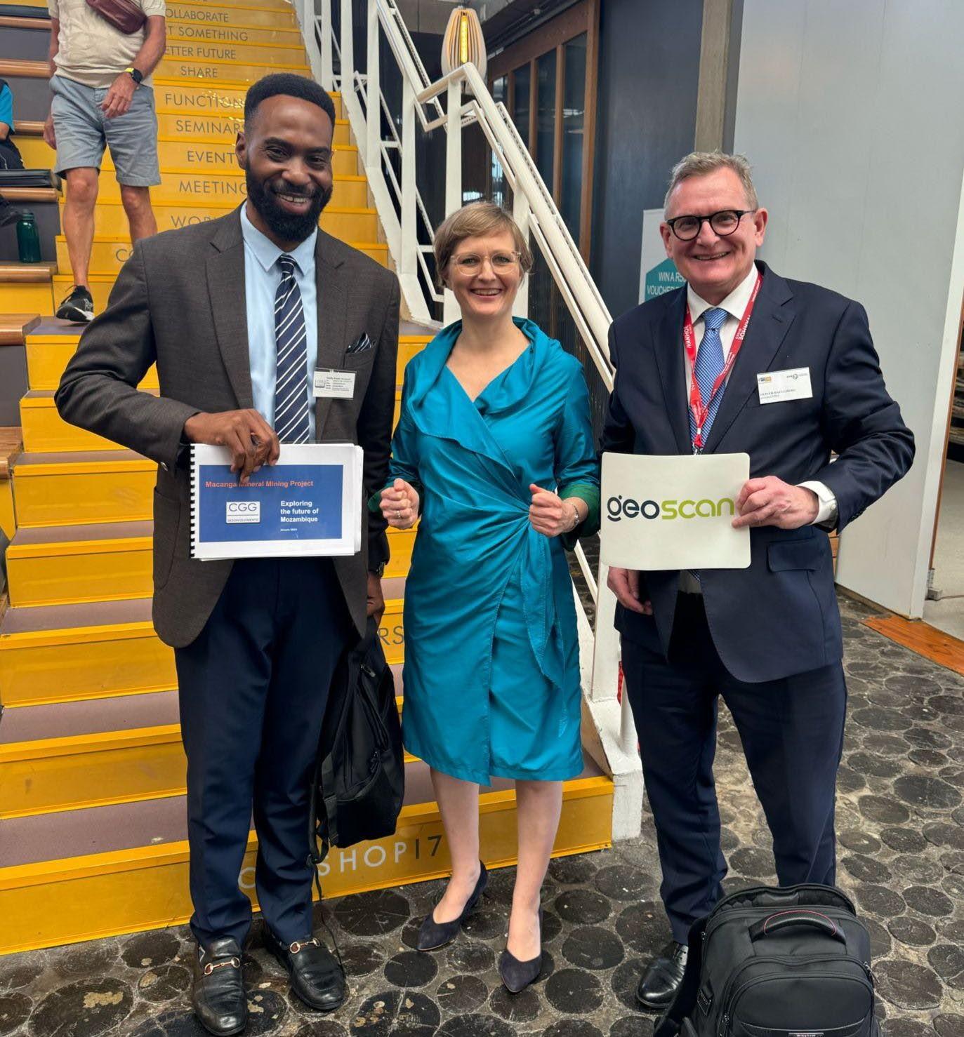
Caption picture; from left to right:

Ms Basavaraju Santhi Sree and Ms Manju Sarma (both National Remote Sensing Centre, ISRO), Mr Roberto Biasutti (ESA) and Frithjof Barner (GAF AG, Neustrelitz) at the site of the German Aerospace Centre (DLR) in Neustre­litz with the antenna TriBand II.

Image: GAF AG

About ESA / ESRIN: www.esa.int/About_Us/ESRIN    

ESRIN, the ESA Centre for Earth Observation, is one of the five ESA specialised centres situated in Europe. Located in Frascati, a small town 20 km south of Rome in Italy, ESRIN was established in 1966 and first began acquiring data from environmental satellites in the 1970s. Since 2004, ESRIN has been the headquarters for ESA's Earth observation activities.

In addition to providing users with data from its own Earth observation satellites, ESA has for many years provided users with access to a number of non-ESA EO missions – so called Third-Party Missions (TPM). ESA’s TPM scheme has been running for more than 40 years, providing EO data to users in Europe and around the world, and currently includes over 60 instruments on more than 50 missions. Through the Heritage programme, ESA is actively working in order to provide free and open access to satellite data acquired by and over Europe, enabling long term studies on our planet.

About GAF AG: www.gaf.de

GAF AG, an e-GEOS (Telespazio/ASI) company, is one of the largest European providers of data, products and information services in the fields of geo-information, spatial IT and consulting for private and public clients. As a result of a merger with its former subsidiary Euromap GmbH, GAF has become the exclusive supplier in Europe of optical Indian remote sensing data from several missions. The company’s archives contain systematic coverage of Europe and northern Africa since 1996, and include satellite raw data from the high and medium resolution IRS missions IRS‑1C, IRS-1D, Resourcesat-1, Resourcesat-2 and Cartosat-1. GAF is also specialised in the production of orthoimage mosaics and digital elevation models from various high and very-high resolution satellite missions. The company is part of the Telespazio Group, which belongs to Leonardo and Thales, two major European technology firms.

About NRSC, ISRO: www.nrsc.gov.in

National Remote Sensing Centre (NRSC) is one of the primary centres of Indian Space Research Organisation (ISRO), Department of Space (DOS). NRSC establishes ground stations for receiving satellite data, generates data products, disseminates to the users, develops techniques for remote sensing applications including disaster management support, geospatial services for good governance and capacity building. NRSC hosts Satellite Data Products from more than 15 Indian Remote Sensing (IRS) satellites right from the first IRS optical mission namely IRS-1A, SAR imaging missions and foreign missions through web portal bhoonidhi.nrsc.gov.in for Indian and international users.

RHEA Group is contributing to the European Space Agency’s (ESA’s) Earth Explorer and other Earth observation (EO) missions, designed to observe different aspects of Earth’s system, through payload data ground segment engineering support service at ESRIN in Frascati, Italy. RHEA staff provide technical expertise through each mission’s life cycle, from the preliminary design to the operations, and the long-term data preservation for missions that have ended their operational life. 

ESA’s Earth Explorers are small research missions, supported by a series of satellites, dedicated to studying specific aspects of the Earth’s environment while demonstrating new technology in space. They survey meteorological and oceanographic activities on Earth, such as the motions of the winds and tides. Others explore the thickness of the polar ice sheets and the nature of Earth's magnetic field. Their objective is to help us better understand the complex processes taking place on our planet, including the atmosphere, biosphere, hydrosphere, cryosphere and Earth's interior, with an overall emphasis on learning more about the interactions between these systems and the impact that human activity is having on Earth's natural processes.

Image © ESA

The Earth Explorer research missions are pivotal to FutureEO, ESA’s EO research and development programme. Since the first Earth Explorer, GOCE (Gravity field and steady-state Ocean Circulation Explorer), was launched in 2009, each mission has continued to surpass expectations. Used by the scientific community, the Earth Explorers demonstrate how breakthrough technology can continually deliver an amazing range of scientific findings about the Earth. They underpin the scientific excellence that is critical to addressing the challenges society faces today – and will in the future – from understanding different aspects of the climate system, such as atmospheric dynamics and ice melt, to societal issues such as food security and freshwater resources.

RHEA is the prime contractor for the Payload Data Ground Segment (PDGS) Engineering Support Services (ESS) consortium, working with three partners: Serco, Solenix and Telespazio. RHEA provides over 65 highly skilled professionals across four areas with specific competencies, with an overarching service management layer that ensures service effectiveness and continuity.   

PDGS ESS – mission lifecycle

Our engineers work on the development of each mission to ensure the integration and validation of the mission’s systems and subsystems. This then passes to the ground segment colleagues supporting the mission operations and coordinating all the relevant activities, including the mission acquisition planning. A third cross-area team supports the common elements shared by the missions, such as data processing and storage infrastructure and security services. We also have a team of experts working on the preservation of data held by ESA to ensure the acquired EO data is maintained over time and made available to the scientific community.

Stefano Tatoni, RHEA’s Business Director, Italy, said, “Under the ESS (Engineering Support Services) contract, our engineers work on some amazing projects, from the preliminary definition phase, where the system requirements and interfaces are prepared and the subsystem and instruments design are defined, through launch, data dissemination and preservation, to the disposal of the satellite. The information gained from these EO satellites is now vital to help us understand our changing Earth and RHEA is very proud to be part of it.” 

Phase 1 of the ESS contract is now approaching closure  and the team is excited to continue its cooperation with ESA for phase 2, which will run until 2026. The team know they will face new challenges as the Earth Explorers move into new mission phases.

Copernicus Data Space Ecosystem is the new portal of the European Space Agency (ESA) for streamlined access to Copernicus satellite data. The portal combines the search and download functionality of the Science Hub with the smooth viewing and easy API access provided by the Sentinel Hub EO Browser. The Ecosystem was launched in early 2023, with new features and updates added in the subsequent months.

For those who are interested in viewing satellite imagery online, new datasets are continually added to the Copernicus Browser, with Sentinel-2, Sentinel-3 OLCI and SLSTR, and Sentinel-5P data already ingested and ready for visualization. Sentinel-3 data are mainly used for ocean colour applications, allowing daily monitoring of water quality changes, sea currents and water temperature. Sentinel-1 data are also becoming available in the next months, providing a view of the Earth's surface unobscured by clouds. These new datasets are searchable in detail thanks to a new filter panel that provides selection based on detailed metadata. The Copernicus Browser is directly compatible with the Custom Scripts developed for the EO Browser. These offer a wide range of custom visualization algorithms relevant for land cover mapping, agriculture, urban development mapping, water quality assessment and many more applications.


A rare cloudless winter picture of Clew Bay and Croagh Patric mountain in Ireland, captured by Sentinel-2 and displayed with the Highlight Optimized Natural Color visualization in the Copernicus Browser.

API Services

For those building services on top of the data access platform, many new API services have recently become available. These include a full implementation of the Processing API, the Statistical API and the Catalog API.

The Processing API is an essential element of add-on applications, allowing generation of personalized visual representations of satellite images and maps but also direct downloading of raw data.

The Catalogue API supports rapid search through data archives for a selected area of interest. In order to facilitate compatibility with user's own code, it is based on the STAC language to describe geospatial data. Using this API allows significant improvement in querying large datasets for images of specific properties.

The Statistical API allows server-side statistical operations on image pixels, directly returning the outcome of calculations from a set of images.

The documentation of the Ecosystem is also substantially updated in order to allow users to get up to speed quickly. Additionally, a user service desk was set up in order to provide case-by-case help.

These new developments already provide substantial new opportunities for data exploration, but also for business application development. The Copernicus Data Space Ecosystem Roadmap (image below) lays out the path ahead: more tools and more data are coming soon.

Useful links:

For the next 6 years, Planetek Hellas will support the Rapid Mapping Component of the European COPERNICUS Emergency Mapping Service (CEMS). With more than 650 events, and over 5000 satellite maps delivered to more than 46 countries in ten years of activity, the service has been supporting the First Response Units around the globe when disasters occurred.

The service provides the European Commission’s Joint Research Centre with on-demand satellite maps of areas affected by natural disasters or humanitarian crises within just a few hours from request. Maps are all accessible free of charge by all civil protection, emergency and territory management users, facilitating damage assessment procedures, allowing relief agencies to respond much more quickly and efficiently.

The Copernicus Emergency Management Service (CEMS) uses satellite imagery and other geospatial data to provide free of charge mapping service in cases of natural disasters, human-made emergency situations and humanitarian crises throughout the world. It covers in particular: Floods, Earthquakes, Landslides, Severe Storms, Fires, Technological disasters, Volcanic eruptions, Humanitarian crises, Tsunamis.

EMS – Rapid Mapping, which is active 24 hours a day 365 days a year, will be operated by a consortium led by e-GEOS and its German subsidiary GAF, Telespazio Iberica in Spain, the Italian company Ithaca, French partners Sertit and CLS, GMV in Portugal, IABG in Germany, Planetek Hellas in Greece and Hensoldt Analytics in Austria.

Over the next six years, the consortium also aims to further improve the service in order to provide maps even faster. With this in mind, the addition of a new Situational Report to the Rapid Mapping portfolio will provide key information on disaster-affected areas, such as exposed population and critical infrastructure, photographic images, as well as multimedia content and open source data, and other useful information to assess the impact of the disaster, within the first 4 hours of activation.

"Operating from Athens, Greece, and being part of a European consortium of top-notch companies that will provide Rapid Mapping products for the Copernicus Emergency Mapping Service, is an honour, a responsibility and at the same time a confirmation of the the related capacity built in Planetek Hellas" Stelios Bollanos, Director of Planetek Hellas, declared.

Learn more: https://www.planetek.gr/news_events/news_archive/2023/03/supporting_the_copernicus_emergency_management_service

https://www.planetek.gr/news_events/news_archive/2023/03/supporting_the_copernicus_emergency_management_service