Skip to content

SpaceSUITE is an Erasmus+ Blueprint project for the development of innovative resources for education and training to bridge the gap between the supply and demand of skills in the ever-growing downstream space sector. The project was kicked off in January 2024, and it will end in December 2027. It integrates 28 partners, including 3 affiliated entities, from Academia, vocational education and training (VET) providers, associations, and representatives of industry companies. The partnership is complemented by 9 associated partners, mainly local and regional public bodies. The project was promoted in the framework of the SPACE4GEO Large-scale Skills Partnership on Space Data, Services and Applications (www.space4geo.euwere EARSC is key partner and will support the achievement of its strategic objectives in the framework of the EC initiative Pact for Skills.

With the aim of ensuring the development of advanced skills in space-related fields and the provision of education and training activities for higher education and VET providers for upskilling and reskilling, in particular for professionals, entrepreneurs, graduates and students, the SpaceSUITE consortium will:

  • release a Sector Skills Strategy, providing details on the way major trends in the downstream space sector are expected to impact skills’ needs in the sector, which will be continuously updated, and defining the roadmap to ensure medium and long term skills development through up-skilling and re-skilling actions for the current workforce, as well as the attraction of talents from other sectors and among youngsters. 
  • enhance and further develop the Body of Knowledge (BoK) on Earth Observation and Geo-information, also embracing Positioning Navigation and Timing (PNT) and Satellite Communication (SatCom), 
  • design “core” curricula for current in-demand and emerging occupational profiles, develop educational and training materials, and organise training actions for different persona, from a technician to a decision maker,
  • create an online “Open Space Academia” to provide these contents in a open flexible manner using the most recent learning techniques and including guidance to candidate learners.

The direct beneficiaries of this action are the 230.000 professionals currently employed by the EU downstream  space sector, which accounts for close to 80% of the global space economy.

Sources:

SDGs-EYES is a three – year Horizon Europe Research and innovation action (RIA) project (January 2023 – January 2026) that aims to strengthen Europe’s capacity to monitor the the Sustainable Development Goals (SDGs) on the basis of Copernicus by building a portfolio of decision-making tools to monitor SDG indicators related to the environment from a cross-sectoral perspective and in line with the priorities and challenges of the EU Green Deal. 

Led by a consortium of 10 partners representing diverse disciplines, SDGs-EYES embodies the spirit of collaboration, cross-fertilization, and knowledge integration. One of the key strengths of SDGs-EYES lies in its ability to combine data from Copernicus’s six core services to develop more accurate SDG indicators. Through a scientific and technological framework, EARSC is leading the using engagement of the project facilitating access to Earth Observation (EO) information while enhancing its usability for a wide range of stakeholders, as e.g. national statistical offices, SDG custodian agencies such as FAO, UNEP, the Inter-Agency and Expert Group on Sustainable Development Goal Indicators (IAEG-SDGs) or the Working Group on Geospatial Information (WGGI), etc.

In addition to its core objectives, SDGs-EYES embarks on a pilot-driven approach. Indeed, the project solutions are demonstrated through four EU and one non EU pilot areas (Sahel Countries, North Sea area, City of Turin (Italy), Romania, and Cosenza province (Italy). 

Overall, SDGs-EYES aims to:

  1. Facilitate Access and Increase Usability of EO Information: SDGs-EYES focuses on designing and developing a robust framework for aggregating and processing EO data provided by Copernicus’s core services and the space and in-situ components. By improving the accessibility and usability of EO information, the project empowers stakeholders with valuable insights for decision-making.
  2. Improve Reliability, Robustness, and Accuracy of SDG Indicators: Through a pilot-driven approach, SDGs-EYES demonstrates the potential of Copernicus-enhanced measurement for six SDG indicators related to SDG13 Climate Action, SDG14 Life Below Water, SDG15 Life on Land, and a cross-goal indicator will be also formulated to explore the exposure of vulnerable communities under cumulative climate extreme. These indicators are evidence of the project’s commitment to advancing the quality and accuracy of SDG monitoring efforts.
  3. Advance Stakeholder Capacity in SDG Monitoring: SDGs-EYES seeks to empower stakeholders by creating a range of user-friendly data products tailored to simplify the tracking and reporting of specific SDGs. These service-oriented products are developed, showcased, and co-designed in collaboration with a diverse community of users and stakeholders within designated pilot areas.

More information about the project are available on the website: https://sdgs-eyes.eu/ and on the project social media channels: LinkedIn (https://www.linkedin.com/company/sdgs-eyes/)  and X (@SDGsEYES)

With the European Digital Strategy, the EU plans to build a strong policy and legislative framework to ensure fairness in the digital environment, stimulate a competitive data market, open opportunities for data-driven innovation and make data more accessible for all. In this context, the Data Act (currently in trialogue negotiations) and the Data Governance Act (entered into force on 23rd June 2022) will support the set up and development of the Common European Data Spaces in making more data available and facilitating data sharing across sectors and EU countries. Following up on the Directive on open data and the re-use of public sector information, the Commission’s DG CNECT has also adopted on December 2022 the Implemented Act on a list of High-Value Datasets.

The Green Deal Data Space (GDDS) will be a transversal, cross-sectoral data space building the Common European Data Spaces among sector-specific spaces. The Green Deal Data Space Foundation, the GREAT project, funded by the Digital Europe program, aims to establish the GDDS and its Community of Practice which builds on both the European Green Deal and the EU’s Strategy for Data. The project will deliver a roadmap for implementing and deploying the GDDS, an infrastructure that will allow data providers and initiatives to openly share their data to tackle climate change in a multidisciplinary manner. By filling in the following questionnaire you will contribute to identifying the challenges and gaps related to the use of Green Deal data and your answers will be used to assess use case proposals.

Click on the link below to open the questionnaire!

https://www.surveymonkey.com/r/X3JVV52

https://www.surveymonkey.com/r/X3JVV52

A number of further economic benefit studies were published over the last couple of months in 2022 within the Sentinels Benefits Study. Oil spill in the Mediterranean looks at how the CleanSeaNet (CSN) service operated by the European Maritime Safety Agency (EMSA) helps national authorities monitoring their waters.CSN uses Sentinel-1 and other data to identify potential oil slicks and possible polluters and, in a matter of minutes, transfer this information to the national competent authorities such as SASEMAR in Spain and Transport Malta. The increased risk of detection and successful prosecution is deterring ship’s captains from washing out their tanks and oil spills were reduced by up to 65% in the last 10 years.

Water Quality Management in Finland looks at how Sentinel-2 and Sentinel-3 data are being used to monitor water bodies in Finland. These measurements allow the environmental institute of Finland and regional environmental agencies, known as ELY Centres, to monitor the quality of water in lakes throughout their region to a degree that is not possible using traditional in-situ water sampling and testing. Using satellite data is especially helpful in a country like Finland where the large amount of water bodies would imply enormous associated costs for authorities should they have to use traditional monitoring methods across the whole country. Sentinel data therefore helps authorities to improve water quality at a lower cost, which in turn improves the quality of life for citizens, aids in the protection of biodiversity and helps to ensure environmental sustainability.

Next to these and other in-depth case studies, we published a visual summary report that provides a great overview of the learnings and conclusions we have been able to draw from our case studies so far. The report also gives a comprehensive picture of all the associated benefits derived from the use of Copernicus Sentinel data!

Besides our case analyses, we organised three sector workshops to engage with public sector stakeholders and to better understand the uptake of Sentinel data in these areas. The targeted sectors were road infrastructure management, forest management and water quality management. The workshop results can be accessed at our SEBS website!

2019 ended very successfully for PARSEC, with two-weeks-long extension of the first Open Call, and 348 applications from 38 countries! If you have already applied, you would like to join or you are still considering how to benefit from PARSEC ecosystem, stay tuned for what is happening in 2020.

After the closing of the application period, more than three hundred applicants are currently taking part in peer-2-peer evaluation. On the 10th of February the evaluation will close, points will be counted, and 100 beneficiaries will be selected.

The selected beneficiaries will meet with PARSEC consortium on the 27th of March in Stuttgart, Germany, to start working on their ideas and on creation of cross-border and/or cross-sectoral consortia. During the three-day-long Bootcamp, beneficiaries will take part in workshops, lectures, coaching sessions, and most importantly, in matchmaking event.

Beneficiaries of Open Call 1 will be looking for partners to form cross-border and/or cross-sectoral consortia throughout the spring. Apart from Bootcamp, accessible only for beneficiaries, five matchmaking events will be organized. To facilitate the access to the events, two of them will be hosted online, while three others will be organized in different regions of Europe. Matchmaking events will invite SMEs, entrepreneurs, innovators, and researchers to cooperate in creating of new Earth Observation-based product or service. Events will be open for representatives from Food, Energy, Environment and Earth Observation sectors, interested in joining the consortia.

The consortia will present their ideas and compete for further funding during two-day-long Demo Day, which will take place on the 3rd and 4th of July in Brussels, Belgium. Interested investors will have a chance to meet innovative teams and to discuss their further development.

To learn more about what PARSEC is up to in 2020 follow us on social media and check our website to learn more about upcoming events (more details soon!). To make sure you don’t miss any date, sign up for PARSEC email updates (subscription available through the website).

e-shape fostering and bridging the European Earth Observation ecosystem

EARSC is one of the leading partners of the 54 members consortium of e-shape (EuroGEO Showcases: Applications Powered by Europe), a 48-month project, lead by ARMINES, and constituted by a pan-European team of academic, industrial, institutional and user communities. Driven by the need to develop operational EO services with and for the users, e-shape is federating communities to increase the knowledge and the awareness on European EO capabilities and new approaches.

e-shape currently includes 27 cloud-based pilot applications under 7 thematic areas to address societal challenges, foster entrepreneurship and support sustainable development, in alignment to the 
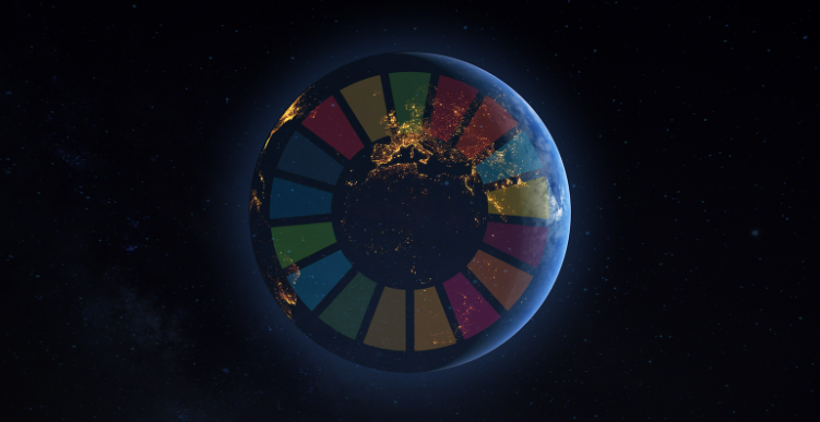
three main priorities of GEO, namely the Sustainable Development Goals (SDGs), the Paris Agreement and Sendai Framework.

e-shape allows Europe to position itself as a global force in Earth observation through leveraging Copernicus, opening new opportunities and expand its use, through the existing European capacities, as well as developing research to business activities.

One of the objectives of EARSC is to invest and promote the users’ uptake of pilots at national and international scale, across vertical markets (private and public) and among key users’ communities; as well as support their sustainability.

e-shape boosts a rich portfolio of innovative key pilots participating in the project.

The seven showcases are:

The food Security and Sustainable Agriculture showcase: largely contribute to SDG 2, it consists of four pilots, which all display Copernicus data sets combined with the necessary in-situ data, weather and soil data that can deliver improved information at global, national and local scale, exploiting the processing infrastructures offered by Copernicus DIAS.

The health Surveillance showcase: will contribute to SDG 3. The three pilots are dedicated to surveillance of pollutants in the environment and their impact on public health through in-situ and space-based environmental observations. They can improve the policy making process and support the assessment of the effectiveness of measures undertaken by nations to achieve the goals of international conventions such as the Minamata convention.

The Renewable Energy showcase:  through its 3 pilots, will engage collaborations between research centres, data providers and end users both in the private and public energy sector. It focuses on SDG 7 and will provide from different European EO sources, innovative and technology mature products and services for renewable energy development and management.

The myEcosystem showcase: will serve focal user groups such as research, environmental assessment, reporting and management by offering seamless access to consistently scaled environmental information on ecosystems from various sources. It will serve SDG 11, 14 and 15. It is formed by three highly complementary pilots, developed to maximize services to user groups both in their specific topical areas, but specifically through integrating and jointly using information from remote sensing (mySPACE), in-situ observation (mySITE) and high-level indicators verification and testing with an exemplary focus on biodiversity (myVARIABLE).

The Water resources management showcase: reflects its multidisciplinary by presenting five pilot activities that focus on its different elements, going from inland waters to coastal areas and the ocean, providing a link to most of the European Directives and Policies and the SDG 6, 7, 13 and 14. These pilot activities will be coordinated by leading institutions and companies of their respective areas, based on work developed in the scope of previous projects and bringing onboard a significant user base to co-design, test and validate the provided services. The pilots will be integrated in NextGEOSS.

The Disasters Resilience showcase: deals with a portfolio of services focusing on natural and human induced disasters (geo-hazards, extreme weather, fires, floods, etc.) aiming at protecting citizens, economies and ecosystems. It is in line with the priorities and the goals set by the Sendai Framework on Disaster Risk Reduction and SDG2 and SDG11. The focus of the showcase, of which the pilots are formed, is to build an effective strategy for successful innovative products leading towards commercialization of EO services that is being composed of the active participation/involvement of both private and public sector (co-designers).

The Climate showcase: is contributing to SDG 13 and to the Paris Agreement. Through its pilots, it will exhibit services to public, private and academia users having a variety of cases from local city scale to global focus. The factor uniting most of these efforts will be seasonal forecast information from the Copernicus Climate Change Services C3S.

Acknowledgment.
The e-shape project has received funding from the European Union’s Horizon 2020 research and innovation programme under grant agreement 820852

Discover more about each pilot here: https://e-shape.eu/index.php/showcases

For more information, you can follow e-shape and EARSC to stay up to date.

Difficulty in scaling up. Can’t reach the researchers that want to use my EO services. Public procurement for research data services is really bureaucratic.

Any Earth Observation company executive may have said this at one point or another.

Niche markets can be challenging to navigate. It’s clear that the market for digital Earth Observation solutions is still developing. What your organisation needs is a little boost. This is exactly what the OCRE, the Open Clouds for Research Environments project, provides. 

Opportunities in the EOSC

The European Open Science Cloud (EOSC) is expected to become the European digital marketplace and virtual environment for 1.7 million researchers and 70 million professional users of research data. It will allow researchers and science and technology professionals to access to a variety of data services and solutions, many of them free, at least from the users side. 

€400 million have already been poured by the European Commission to make it into a reality since 2017, and an alpha-stage prototype of what it could look like exists, as seen in the EOSC Portal (www.eosc-portal.eu). By 2021, a more operational EOSC is expected to be launched. 

Multiple projects have been funded to make the EOSC a reality. One of these projects is OCRE. In this current early stage of the EOSC’s development, OCRE provides a clear route for commercial service providers of cloud and digital Earth Observation solutions to be involved with the EOSC early on.

How to get involved

As of September, OCRE has been gathering the requirements of researchers and is pooling and grouping demand from various universities and research institutions into buyer groups. To-date. institutions from up to 39 countries have already expressed interest to be part of the tender. This represents a clear demand for commercial services. 

Aside from the commitment to procure in OCRE’s tenders, the European Commission has allotted more than €3.2 million in adoption funding to OCRE which will be used by these buyer groups and institutions specifically for Earth Observation services.

OCRE’s Earth Observation Tender is expected to be published within 2019. Once it’s published and the commercial Earth Observation services have been selected, consumption will begin starting next year, 2020.

OCRE will support the succeeding Earth Observation service providers to onboard their services into the European Open Science Cloud. This will be achieved through the active collaboration between OCRE and EOSC-hub, another EOSC initiative tasked with onboarding services for the EOSC. 

The tender is expected to select more than one succeeding supplier. This provides better chances for suppliers that will respond to the tender.

Next Steps

A Prior Information Notice will be provided by OCRE to interested Earth Observation suppliers allowing feedback to be provided to the OCRE Earth Observation Tender. Feedback will be accepted for a limited time only. Following this, the OCRE Earth Observation Tender will be published.

All interested suppliers are invited to join the OCRE Community Network as Earth Observation companies to be informed of the latest important tender developments: ocre-project.eu/join.

EO4GEO is an Erasmus+ Sectoral Skills Alliance aiming to bridge the skills gap between supply and demand of education and training in the EO/GI sector. Started in January 2018, the project will run for 4 years: almost at half of its duration, it is showing significant step forwards in the development of its results, which will be of interest for education within the space/geospatial community.

One of the project outcomes is the realisation of a Body of Knowledge for the space/geospatial domain. Thanks to a network of experts, the BoK will contain the definition of more than 1000 concepts of the sector. Up to now, the concepts have been identified: the experts are now starting to elaborate on them. More information on the development of the BoK are described in this article.

EO4GEO is also designing a series of curricula cleverly linked to the occupational profiles of the sector, with particular attention to the tasks and duties needed by the workforce. The clear identification of the skills needed will permit future workers to approach the labour market adequately prepared. How the occupational profiles are being identified is explained here.

EO4GEO’s curricula will also be based on the studies on the business processes in the EO/GI field. This innovative approach gives strong consideration of market requirements: the idea behind is that business processes show tasks that the workforce deal with during their work. Studying them will enable to understand which skills are needed. The design of curricula will also be the focus of the next EO4GEO workshop, scheduled in Warsaw on the 27th of November.

Follow EO4GEO on the website and on Twitter to be updated on the outcomes, activities, news and events of the project.

We are very pleased to inform our community about the release of the Space / Geospatial Sector Skills Strategy

The needs of the sector are constantly evolving, and we believe that helping the industry to find workers with the right skills and ensuring that they acquire the skills they need to find productive employment is key to the sector economic innovation, growth and competitiveness, therefore EO4GEO aims to define a long-term and sustainable strategy to fill the gap between supply of and demand for the EO/GI education and training.

This document presents the strategic views under the Space/Geospatial Sector Skills Strategy. It proposes a concrete vision, mission and goals that will be used in the definition of a long-term action plan (LTAP) to address short- and medium-term skills needs in the areas of skills, knowledge and competences. Specific actions to be taken by a diverse group of stakeholders are described, in order to establish an ongoing dialogue between the EO4GEO partnership, external stakeholders and entities within the EU directories (specially the European Commission DG on Employment, Social Affairs and Inclusion (DG-EMPL) and DG Internal Market, Industry, Entrepreneurship and SMEs (DG-GROW)) and Member States through their Ministers of Education.

In this report, a first version of the strategy is outlined, aiming to reduce the gap and eliminate the mismatch between the supply of and the demand for education/training in the Earth Observation (EO) and Geographic Information (GI) sector taking into account wider technological, societal and policy developments. The LTAP which will be created based on the Sector Skills Strategy recommendations outlined within, and discussions stemming from, will then be updated as appropriate to take account of lessons learnt throughout the EO4GEO project, open discussions with stakeholders and also future technological, societal and policy developments.

The VISION of the Sector Skills Strategy is to foster the growth of the European EO/GI sector ensuring a workforce with the right skills, in the right place, at the right time.

The MISSION of the Sector Skills Strategy is to ensure the strategic cooperation among stakeholders on skills development in the EO/GI sector (Sector Skills Alliance). This cooperation will support growth, diversity, and flexibility of the sector by providing harmonized and improved educational offers at a range of different learning levels including VET and academic training and the development of new occupational profiles for the EO/GI sector.

By adopting a forward-looking perspective, the following GOALS have been identified for the successful implementation of the Sector Skills Strategy. These goals might not be fully reached during the EO4GEO project but are recommended to be followed up as part of the LTAP:

  • A strategic collaboration between the skills alliance, private sector, government and “end user” sectors is established.
  • A political commitment at EU level (DG-GROW and DG-EMPL) to stimulate innovative skills development policies is ensured.
  • A coordinated effort to improve competitiveness and to penetrate other sectors through market intelligence across stakeholders is created.
  • The EO/GI awareness of and engagement with “end user” sectors is improved leading to increased uptake of Copernicus data and information services.
  • Harmonised curricula and training offers (including workforce mobility) at pan-European but also international levels are improved and developed.
  • A standard for describing key qualifications is promoted.
  • The use of EO/GI services as an inspiring and innovative context for learning across all age groups and value chains is encouraged and supported.
  • Skills needs are mapped to better define teaching supply, with a focus on flexible learning pathways.

If you have interest on the Space-Geospatial_Sector_Skills_Strategy, please contact EARSC. This strategy is now opening a dialogue with stakeholders as well as to stimulate discussion on priorities and concrete measures, in order to facilitate the implementation of future upskilling strategies.

More information on EO4GEO "Towards an innovative strategy for skills development and capacity building in the space geo-information sector supporting Copernicus User Uptake” could be found at http://www.eo4geo.eu

eoMALL beta release is now live

eoMALL beta release is now live (https://eomall.eu) to help EO and non EO users understand how online services are used and to access them, to help companies improve their understanding of the online market customer’s needs and get leads. Discover the spirit of the future eoMALL, its landing page, its navigation, … your feedback is more than welcome. Currently as a beta version, discover the first services promoted and companies involved in the platform. Other companies and services are already planned. Want to promote your services? Contact us!