
JOIN US ON 12 & 13 JUNE 2024 IN BRUSSELS AND ONLINE FOR THE 2024 EDITION OF EXPANDEO!
We are happy to invite you to EXPANDEO 2024! EXPANDEO, the European Association of Remote Sensing Companies (EARSC)’s annual event, where the market meets, provides a key platform for European Earth Observation companies, institutional actors and various other stakeholders to interact and network, learn about current policies and their impact on the industry, as well as reflect on challenges and explore new horizons.
Join on June 11th for PROTECT’s Final Event
Join us on June 11th for PROTECT’s Final Event, held in Brussels as part of the EXPANDEO 2024, organized by EARSC. This full-day event is a celebration and culmination of the PROTECT project’s journey, supported by funding from the Horizon Europe Framework Programme.
EARSC signed a MoU with the African Network of Geomatics Professionals (RPAG)
The MoU aligns with the objective of strengthening and deepening working relations between the two associations in areas of mutual interest related to Earth Observation capabilities and capacity building activities, with a focus on collaboration between Africa and Europe. The MoU entails regular exchange of information, cross-promotion of mutual opportunities and interests in collaborative export business, cooperation in the marketing of showcase applications of mutual interest, organisation of joint meetings/events, and exploration of collaborative research opportunities.
Strengthening Sustainable Development Goals Monitoring via Copernicus
SDGs-EYES is a three - year Horizon Europe Research and innovation action (RIA) project (January 2023 - January 2026) that aims to strengthen Europe's capacity to monitor the the Sustainable Development Goals (SDGs) on the basis of Copernicus by building a portfolio of decision-making tools to monitor SDG indicators related to the environment from a cross-sectoral perspective and in line with the priorities and challenges of the EU Green Deal. [...]
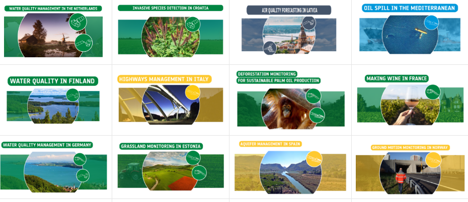
The latest from the Sentinel Benefits Study
Visit the Sentinel Benefits Study website and discover the new cases on Wildfire management in Greece and Air Quality Forecasting in Latvia.
Skills and Workforce
The Large -scale Skills Partnership (LSP) for Space Data, Services and Applications (SPACE4GEO), promoted under the European Commission’s (EC) initiative Pact for Skills, aims to empower workers with the skills needed for the development of future innovations and to achieve the aims of the EU's Space strategies. [...]
Skills and Workforce
SpaceSUITE is an Erasmus+ Blueprint project for the development of innovative resources for education and training to bridge the gap between the supply and demand of skills in the ever-growing downstream space sector. The project was kicked off in January 2024, and it will end in December 2027. [...]
Navigating the future of carbon farming: insights from the first EU Carbon Farming Summit
The first-ever European Carbon Farming Summit hosted by the EU-funded CREDIBLE project (www.credible-project.eu) convened in Valencia (Spain) in March 2024 a vibrant community of over 600 professionals, organisations and enthusiasts dedicated to carbon farming and soil management. The event highlighted the community's strong commitment and enthusiasm for recognising the potential of carbon farming. . [...]
Policy Observatory
Under the Policy Observatory, EARSC is monitoring relevant EU policies and advocating for increased use of the EO services to support policy-makers.
EOFIN, Earth Observation for financial management
The EO-FIN project is funded by ESA as a series of EO best practices. The main purpose of this activity is to understand what the current, and short-term future, capabilities of EO are to support the Financial Management sector, and what EO best practices need to be met to best respond to this sector’s needs and requirements. GMV in partnership with London Economics are responsible for completing these activities. The EO-FIN project is 18 months and started in January 2023. In tandem, this activity aims to promote and expand, through standardisation, best practices and awareness-raising, the development and expansion of high-quality EO services in the said sector. More specifically, the objective of the present activity is to establish the current geo-information needs and requirements within the sector of Financial Management (FM), identify the best practices allowing the EO industry to respond to these requirements through high-quality, standardised, EO products and services and, finally, define a roadmap for the implantation of these EO best practices. For this activity, the FM sector will be represented by stakeholders operating in the following four FM markets: Investment Management, Risk Management, Insurance Management and Green Finances.[...]
Harvesting Earth Observation data for offshore renewables: BLUE-X project kicked off to speed up the energy transition.
Seven European partners, including offshore renewable energy and Earth Observation specialists, have teamed up for the BLUE-X project. Together, they will develop a satellite-based decision support tool to accelerate offshore renewable energy deployments. This is the first blue energy Horizon Europe project funded by the EU Agency for the Space Programme (EUSPA). [...]
GeoScan and CGG Desenvolvimento sign agreement on exploration of critical minerals in Mozambique at INDABA
Capetown, South Africa, 06.02.2024: During INDABA, the premier conference on mining and mining technologies in CGG Desenvolvimento Sociedade Unipessoal Mozambique LDA signed a comprehensive Memorandum of Understanding for exploration of critical minerals such as lithium, nickel or copper in Mozambique.. [...]
GAF AG- CLC+ Backbone raster product updates for the reference years 2023 – 2025 awarded
The European Environment Agency (EEA) has awarded an international consortium led by GAF AG with partners GeoVille, e-GEOS and Telespazio Ibérica, with the production of the updates of the CLC+ Backbone Raster Product for the years 2023 and 2025 as part of the Copernicus Land Monitoring Service (CLMS). […]
Planetek Hellas signs new contract with ESA to support the INTERPOL’s Counterterrorism Unit
Planetek Hellas, a frontrunner in Satellite Earth Observation (EO) based intelligence solutions for security, law enforcement and defense, has entered a crucial phase of collaboration with the European Space Agency (ESA) through a newly signed contract. The contract is part of ESA’s EO for Civil Security Applications initiative, a cornerstone of the Agency’s FutureEO‐1 program. . […]

Cloudless Quarterly Sentinel-2 Mosaics added to the Copernicus Data Space Ecosystem
The Copernicus Data Space Ecosystem, the official data infrastructure for Sentinel imagery, is now growing with the gradual addition of new data products. Cloudless Quarterly Sentinel-2 Mosaics are Level 3 analysis-ready data: a seamless, radiometrically and geometrically corrected, obstruction-free data product from each quarter's image pixels. They enable broad-scale observation and robust data analysis and are completely open and free. The datasets can be accessed in Copernicus Browser or via STAC, OData, openEO or the Sentinel Hub APIs. […]
Building Greener, more sustainable Cities: Insights from Latitudo 40’s Climate Adaptation Strategies and the EarthDataPlace Marketplace
IIn today’s rapidly evolving world, the fusion of Artificial Intelligence (AI) and satellite technologies is unlocking unprecedented opportunities for sustainable and resilient urban development. These tools are reshaping our approach to managing territories, offering solutions that help to address the urgent challenges of climate change. This exploration takes a closer look at the transformative potential of integrating AI with Earth Observations, highlighting Latitudo 40’s technologies, fostering healthier, more sustainable urban landscapes. .[...]
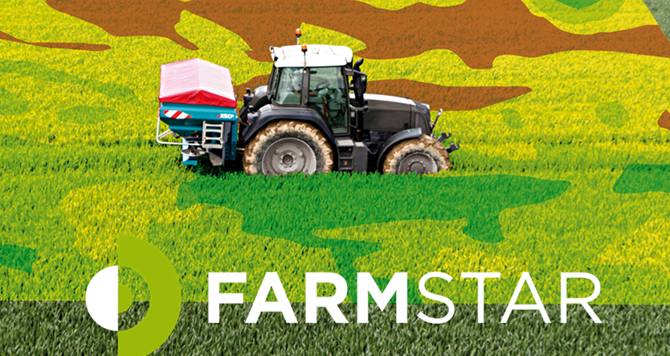
Revolutionizing Agronomy with Farmstar and the CHN Method
Combining advanced technologies and innovative agronomic practices is critical to making agriculture more sustainable and resilient to climate change. Farmstar, a pioneering solution in the French market for over 25 years, is an excellent example of this evolution. The company is now introducing the CHN method to its service, which will assist farmers in using nitrogen fertilizers more intelligently. With this improved service, farmers will be able to better manage their crops and contribute to the fight against climate change.[...]
Rapid information retrieval from space for a better decision-making process with HyperScout®: the use cases of Thales-Microsoft’s IMAGIN-e and South Australia’s Kanyini missions
The HyperScout® product, by Dutch company cosine, is a line of miniaturized hyperspectral imaging instruments models produced in series and equipped with onboard analytics capability. They are designed to fit satellites the size of a shoebox, capturing images of Earth in a multitude of colors beyond the human eye’s perception. HyperScout enables real-time monitoring of various natural disasters such as floods, forest fires, desertification, ice detection, crop health, and more. Its capabilities have the potential to significantly enhance society’s decision-making processes regarding climate policy. In 2024, a HyperScout product will be deployed in space as part of two high-profile operational missions, focused on addressing climate change, environmental monitoring and leveraging the power of artificial intelligence: Thales-Microsoft’s IMAGIN-e and South Australia’s Kanyini. [...]
How satellites help to protect Europe’s ancient forests
There is something eerie about seeing these dots of light gliding through the night sky. Today, satellites orbit the earth as a matter of course and enable navigation systems to determine locations to the nearest metre, provide data for weather forecasts or transmit television programmes. But satellites and nature conservation? [...]
Satellite-Derived Solutions for the Canal Seine Nord Europe Project
The Canal Seine Nord Europe stands as a monumental testament to modern engineering, arguably the most significant civil engineering project in Europe this century. With its vast scale, the project encompasses a decade of work, stretches over 100 kilometers, and involves the excavation of more than 70 million cubic meters of soil. Yet its ambitions go beyond mere construction; it aims to transform goods transportation in Europe, promising to divert approximately 5 million trucks from the roads annually, significantly reducing carbon emissions and traffic congestion.[...]
Improved tasking flow, advanced processing capabilities, new collections in the catalog, and more
We released a new tasking flow last year that significantly improved the way our customers task satellites. Since then, we’ve continued to refine our tasking offering, enabling you to track tasking orders better.[...]

Spottitt Provides a Solution to Automatically Detect Changing Conditions on the NSW Road & Rail Network
Spottitt became Finalist in Transgrid’s Challenge for real-time insights for company’s easement route planning and Champion for Transport for NSW Challenge for tracking safety of roads and railways using satellite data. [...]